"Reggio Città dei Sentieri" (Reggio, City of Trails) is a participatory project by the Municipality of Reggio Emilia and its citizens, aimed at creating a network of accessible trails throughout the municipal area for improved sustainable mobility and a new way of discovering the city, both inside and outside the historic center. The network of cycling and walking trails in Reggio Emilia represents an important sustainable mobility infrastructure and a "gateway" to a significant cultural and community heritage, as it promotes social interaction, educational content, experience and direct knowledge of the environment, landscape enhancement, and the recovery of memory linked to the territory.
These paths, defined together with citizens during "design walks," wind for a total of 160 kilometers along bike paths, trails, and dirt roads, depending on their geographic location. It is a dense network of trails and routes to rediscover the city inside and out, in every corner of the municipal territory, from the palaces of the center to the quiet of the countryside.
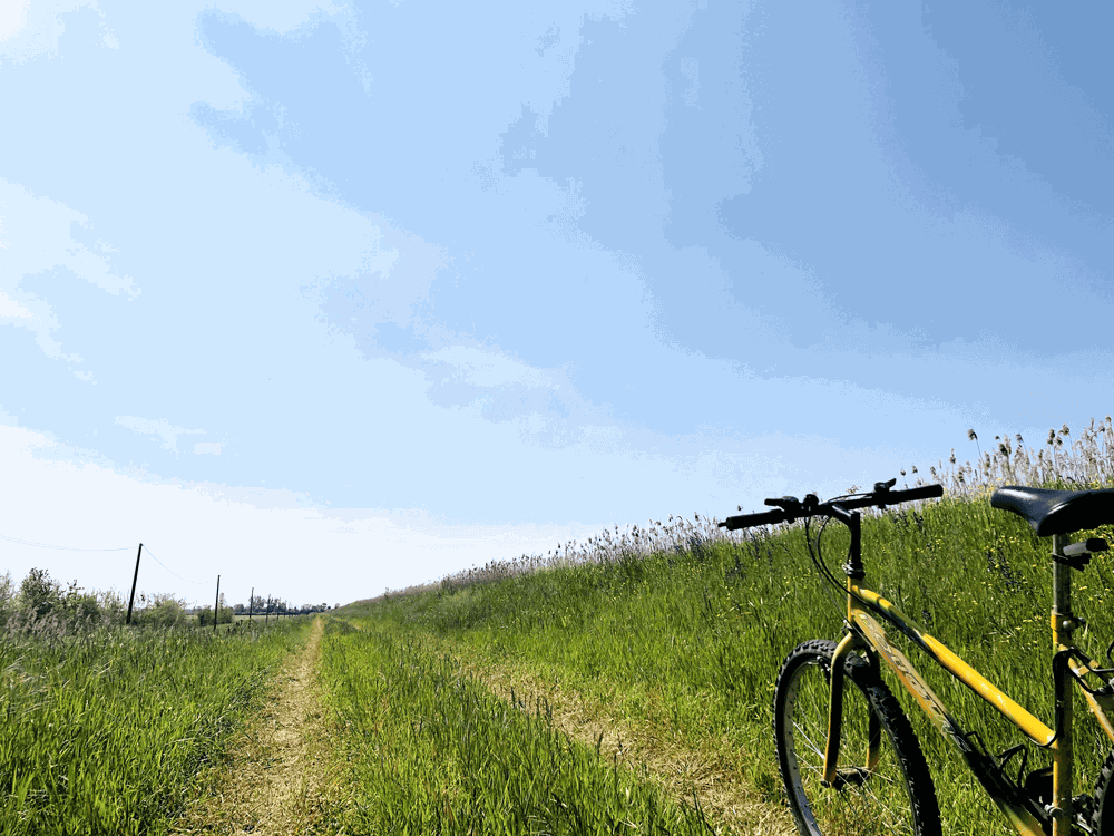
All routes are of low difficulty and can be traversed on foot or by bike by people of all ages and fitness levels. Please pay attention to any potential hazards and/or pedestrian crossings on roads. For more information and detailed trail sheets, please visit the website www.comune.re.it/cittadeisentieri
All routes are available on the official "Sentieri Appennino" app by GeoMedia. You can also consult the routes at our IAT-R office (Via Farini 1/A - 42121 Reggio Emilia).
All routes are managed by the Municipality of Reggio Emilia, in partnership with CAI Reggio Emilia, FIAB RE, Consorzio di Bonifica dell'Emilia Centrale, UISP, Ente Parchi Emilia Centrale, WWF Emilia Centrale, ISTORECO (Institute for the History of the Resistance and Contemporary Society), local associations, companies, and private citizens.
There are 23 routes all throughout the municipality territory:
1 - Anello della Rosta (Sentiero CAI 646R)
2 - Anello della Canalina (Sentiero CAI 646G / 646S)
3 - Anello Alex Langer (Sentiero CAI 620G)
4 - Anello di Santa Croce e delle Reggiane (Sentiero CAI 646R)
5 - Strada della Biodiversità (Sentiero CAI 642F)
6 - Anelli di Canali-Il Pozzo e Canali-Castello (Sentiero CAI 646J)
7 - Anello di Roncocesi (Sentiero CAI 620A)
8 - La Via delle Ville (Sentiero CAI 646D)
9 - Anello del Campovolo (Sentiero CAI 646P)
10 - Sentiero Reggio - Corte Valle Re (Sentiero CAI 620)
11 - Anello del Castello di Cadè (Sentiero CAI 620C)
12 - Anello di Villa Cella (Sentiero CAI 620B)
13 - Anello di Cavazzoli (Sentiero CAI 620D)
14 - Giro delle Acque di Pieve Modolena (Sentiero CAI 620F)
15 - Tratto urbano del Sentiero dei Ducati
16 - Anello di Canali e Fogliano (Sentiero 646L)
17 - Tratto urbano del Sentiero Spallanzani
18 - Sentiero del Canale di San Maurizio, con anelli del Mauriziano e diram. per Gavasseto e Castellazzo (Sentiero CAI 610)
19 - Anello dei Murales di Corticella (Sentiero CAI 610F)
20 - Greenway del Rodano e anelli di Gavassa e Cirenaica (Sentiero CAI 646M)
21 - Tratto urbano della Via Matildica del Volto Santo
22 - Anello di Villa Sesso (Sentiero CAI 620H)
23 - Anello di San Prospero Strinati (Sentiero 620E)
Rosta Loop
The CAI 646R trail is an urban loop route that begins and ends at the Rosta Nuova social center, winding through the Rosta Nuova neighborhood and partially through the Pappagnocca and Buco del Signore districts.
It follows a historical itinerary that touches upon several points of interest—some no longer visible—such as the canals and related water infrastructure that crossed the territory when it was characterized as a rural area belonging to the "villa" (hamlet) of San Pellegrino. Today, some of these features are buried, such as the Buco del Signore canal, or have been demolished, such as the ancient Rosta mill.
In addition to the water features, most notably the thousand-year-old Secchia Canal, other notable highlights include significant architectural landmarks and remarkable vegetation. The latter features prized trees such as the large monumental oak on Via Marzabotto and the white poplar in the Noce Nero park, which was planted in 1997 by a spiritual leader of the Lakota (Sioux) tribe. Of great urban planning interest is the former INA Casa "Rosta Nuova" residential development (1961) on Via Wybicki.
Canalina Loop
The itinerary spans across Via della Canalina, a road axis of Roman origin lined with valuable trees, and consists of two loops identified as CAI trails 646G and 646S.
The starting and ending point of the route is Villa Magawly (16th century), nestled in a woodland of significant botanical interest.
The first loop, CAI trail 646G “Canalina 1”, passes through the Peace, CLN, L’Acacia Rosa, and I Platani parks, touching upon the San Pellegrino business center, the INA-Casa Crocetta neighborhood (Via Bismantova), the Betulla 21 district (built on the former Villaggio Catellani), and the Compagnoni-Fenulli neighborhood.
The second loop, CAI trail 646S “Canalina 2”, leads to Il Noce park (Nuovo Villaggio Catellani), which hosts a mural dedicated to the world-renowned basketball player Kobe Bryant, an adopted son of Reggio Emilia. It covers several points of interest, including the Villaggio Architetti (INA-Casa Nebbiara), the Centro Insieme, the sites of the former Artigianelli and the former OSEA, and the new Walpot park.
The southern portion of the route is part of the transition zone of the UNESCO MAB Appennino Tosco-Emiliano Biosphere Reserve.
Alex Langer Loop
The loop covers a peri-urban area located between Orologio, Pieve Modolena, and Regina Pacis.
The starting and ending point is the Alex Langer Garden, a space dedicated to interreligious and multicultural dialogue and for this reason named after the pioneer of environmental and pacifist thought.
The itinerary crosses places of significant historical relevance such as: the Casino Ottavi, which in 1944 hosted a clandestine meeting between Benito Mussolini and the Nazi Field Marshal Albert Kesselring; the Bosco Terrachini which, after having hosted a division of the German army during the Second World War, was the site of the first Feste de l’Unità in the post-war period; the "Paolo Davoli" park named after the partisan martyr of Cavazzoli, silver medal of the Resistance; the Parco del Gelso, which takes its name from the monumental tree housed inside the Casino dell’Orologio, which in turn was born as a noble country residence and is today a socio-cultural aggregation hub of the neighborhood.
Santa Croce and Reggiane Loop
The Santa Croce loop is a route that begins and ends in Piazzale Europa.
It crosses the Parco del Ciliegio and the gardens of Via Monte Nero, the Reggio canal (formerly Enza canal), and the sports fields of the Reggiana football club. Historically, it touches the large complex of the former Reggiane workshops, which today house the Tecnopolo, the Loris Malaguzzi International Center for Children (located in the former Locatelli cheese warehouses), the railway workers' houses of Via Veneri, and the small church of the Madonna dello Zappello on Viale Ramazzini. This symbolic place of worship is located in front of the "regenerated" space of Viale Ramazzini 33, once the home of the glorious Maffia club, and the small church of Gesù Operaio, which had as its chaplain Don Gaetano Incerti, the "combative" priest of the Reggiane.
The 646Z itinerary (i.e., the 1.3 km junction) touches the neoclassical Villa Cougnet, former seat of District VII and now a library, and the highly popular districts of Cairo (now disappeared) and Villaggio Pistelli (formerly Corridoni).
Biodiversity Path (Strada della Biodiversità)
It is an itinerary between nature and companies operating in the prestigious countryside located on the Ghiardo moraine plateau, west of the city. The path is located within the landscape area between the agricultural river parks of the Modolena and Quaresimo streams and develops as a walk that connects Coviolo with Codemondo and Rubbianino. Registered by the CAI as 642F, it also includes a loop variant on the ancient military road Riccò (Via Pomponazzi). The project sees the participation of about ten local companies operating in the field of biodynamic agriculture, zero-km catering, and hospitality businesses. The entire route runs within the transition zone of the MAB Unesco Tuscan-Emilian Apennines.
Canali-Il Pozzo Loop
The route is the first of two loops located on the right bank of the Crostolo, between San Pellegrino and Canali.
The first loop (CAI trail 646J “Anello Canali 1”), 3.4 km long, starts at the pedestrian and cycle bridge of Via De Sanctis (formerly Viazza del Pozzo) as an eastern branch of the Crostolo greenway. Characterized by a wilder and uncultivated landscape compared to that of the Crostolo walk, it grazes the Oasi del Gruccione, a former quarry so named after the small bird that nests there but is distrustful and rather difficult to see.
The second loop (CAI trail 646Y “Anello Canali 2”), 2.8 km long, has the Canali social center as its stronghold, branching off, via new cycle and pedestrian paths, to the old mill of the hamlet, a production plant that belonged to the Duke of Modena, then to the Corbelli counts: existing already in the 1600s, it remained active until the second half of the 20th century under the Davolio Marani family. The itinerary is part of the transition zone of the MAB Unesco Tuscan-Emilian Apennines.
Canali-Castello Loop
The route is the second of two loops located on the right bank of the Crostolo, between San Pellegrino and Canali.
The first loop (CAI trail 646J “Anello Canali 1”), 3.4 km long, starts at the pedestrian and cycle bridge of Via De Sanctis (formerly Viazza del Pozzo) as an eastern branch of the Crostolo greenway. Characterized by a wilder and uncultivated landscape compared to that of the Crostolo walk, it grazes the Oasi del Gruccione, a former quarry so named after the small bird that nests there but is distrustful and rather difficult to see.
The second loop (CAI trail 646Y “Anello Canali 2”), 2.8 km long, has the Canali social center as its stronghold, branching off, via new cycle and pedestrian paths, to the old mill of the hamlet, a production plant that belonged to the Duke of Modena, then to the Corbelli counts: existing already in the 1600s, it remained active until the second half of the 20th century under the Davolio Marani family.
The itinerary is part of the transition zone of the MAB Unesco Tuscan-Emilian Apennines.
Roncocesi Loop
The 620A itinerary is a route characterized by two hiking loops that graze the CAI 620 'Reggio Emilia-Corte Valle Re' trail.
The first loop (4.00 km) originates from the square of Roncocesi: it reaches the Modolena stream via the so-called “Carrobbio” (Via Rolando Iotti). The route leads towards Casa Fontanesi, a place linked to the Resistance and anti-fascism. From the bank of the Modolena, after crossing the A1 and the TAV, one arrives in Via San Biagio, where until the 16th century the primitive church and the castle of Roncocesi were located, then moved to the current location due to continuous flooding. From there, one returns to the center of Roncocesi, the birthplace of the singer Adelmo “Zucchero” Fornaciari and the last residence of the photographer Luigi Ghirri.
The second loop (5.00 km) detaches from the bridge over the Modolena on Via San Biagio towards the San Silvestro canal, then turning south towards the Felesino area, which takes its name from the ferns established there. During the Liberation War 1943-1945, the area became important for having hosted the “Hideout Houses” for the partisans of the 76th Garibaldi Brigade operating in the area. In the center of Roncocesi, the two Amarenzio Montanari parks on Via Iotti and the wooded area next to the dairy recall the work of Paride Allegri, former partisan commander and later head of the municipal greenhouse, who planted the trees present.
Campovolo Loop
The circuit develops around the airport area, enclosing it entirely. It connects through two branches to Piazzale Europa, where the Tecnopolo and central station are located, and to Via Caduti delle Reggiane, where the provincial headquarters of the CAI and the Reggio-Gavassa cycle connection insist.
Inserted in the green wedge of the Reggio airport, it describes an irregular circle flattened, to the north, by the Reggio (formerly Enza) and Calvetro canals and, to the south, by the Milan-Bologna railway. To the east, it is delimited by the road axis to Gavassa and Correggio and to the west by the Rodano stream. It touches four natural parks:
the urban woods Enrico Berlinguer and Paride Allegri, the reforestation area located between the Reggiane and the Via del Partigiano railway overpass, and the Rodano agricultural-river park.
For a few hundred meters, it grazes the new RCF Arena Campovolo connecting the Villa Curta bridge with Via Vertoiba.
At the San Lazzaro railway stop, it connects with the university campus of the same name, as well as the headquarters of the Health Dept of Reggio Emilia, and with the southern route of the Rodano greenway, towards the Mauriziano.
Cadè Castle Loop
The route was created as an extension to the Paverazzi locality of the CAI 620C trail, which is in turn a branch of the CAI 620 itinerary of Corte Valle Re. From Via Giordano Bruno (Via Emilia), it winds along Via Castello, drawing a loop that touches Via Piave, Via Villa Chiara, Via Casel di Ferro, and Via Abele Fantini, finally rejoining the initial road in the locality of Castello di Cadè.
The route touches the northern appendix of the agricultural area of Barco, in the municipality of Bibbiano, and the ancient estates of the Magnani-Rocca foundation.
In the Paverazzi locality, it connects to the 640A trail that ends at the former Matildic convent of Montefalcone.
Villa Cella Loop
The track winds through the countryside of Cella located north of the Via Emilia, between the Milan-Bologna railway and the old parish church, now in ruins.
The itinerary is formed by two loops placed respectively north and south of the railway line and connected to each other via the underpass of Via Delmino Spaggiari.
The southern loop grazes the inhabited center of Cella, passing through Via Croci and the first stretch of Via Spaggiari; the second loop, located to the north, touches the part of greatest landscape value, insisting on the ancient route of Via Cella all’Oldo (today Via Senna) which leads to the old church and the castle to then fold back on the fontanile of Via Tevere, the only one active on site.
Cavazzoli Loop
The itinerary represents a variant to the CAI 620 ‘Reggio Emilia-Corte Valle Re’ trail. It is a circular hiking route inside the inhabited center of Cavazzoli which, starting and ending at the Rondò club, touches several points of historical interest of the "villa" (hamlet). Among these, the following stand out: the ancient terramara, the Casino Nobili, the church of Ognissanti, the birthplace of Cesare Campioli, the mayor of the Liberation, the Rondò cooperative, the memorial stone to the victims of the 1944 massacre, located a few hundred meters further west of the home of the martyr Paolo Davoli, silver medal of the Resistance and brotherly friend of Campioli.
A short walk rich in history that does not forget to mention the protagonists of the second half of the 20th century in Cavazzoli: Raffaele Campioli, nephew of Cesare, cooperator and historical founder of the Rondò, and Don Bruno Zinani, parish priest of this community for more than half a century. Figures who, albeit in different ways, worked daily for the common good, in a path that saw them both miss the same day in the same place, defeated like many by COVID-19. Immersed within the peri-urban agricultural environment of the Crostolo stream, the track overlaps with the Green Belt itinerary, from which a branch leads to the Valle di San Giulio and its ancient oratory (17th century). Through the two footbridges on the Crostolo, the loop is connected to the Landscape History Paths of Villa Sesso (CAI 620H trail) and the San Prospero Strinati Loop (CAI 620E trail).
Canali and Fogliano Loop
The loop develops in the vast agricultural area located between Canali, Fogliano, and the municipality of Albinea, placing itself between the Crostolo river park and the Rodano park.
It is an itinerary totally wedged into a vast agricultural area crossed by the Rio Acqua Chiara and the nearby abandoned paleochannel of the Crostolo which connected the current course of the main stream of the city to the Rodano. It begins near the church of San Marco, in Canali, and touches several monumental complexes, including Corte San Giorgio, La Razza, Villa Veneri in Fogliano, the farm and the San Raffaele oratory of the Reggio hospital, and the Corte dei Frati.
Of notable interest is also the hydraulic artifact at the intersection between the Secchia canal and the Rio Acqua Chiara.
The loop is about 1 km away from both the Crostolo and Rodano river parks and is part of the transition zone of the MAB Unesco Tuscan-Emilian Apennines.
San Maurizio Canal Trail
The itinerary constitutes a direct connection between the city of Reggio Emilia and the municipality of Rubiera where, through the Parks Cycle Path, it connects to the Corte Ospitale and the Nature Reserve of the Secchia river expansion basin.
It begins in San Maurizio, where it hooks onto the Spallanzani trail through a loop and leads to the Oasis of Marmirolo where, through a further loop, it continues towards Rubiera, tracing the towpath of the San Maurizio canal embankment to then reach Via Chiessi in Bagno.
In addition to the San Maurizio and Oasis of Marmirolo loops, the trail includes two branches.
The branch to Gavasseto (4.26 km), where it then connects to the Spallanzani trail, leads to the fontanile of the Ecological Rebalancing Area of the Ariolo fontanile, an open-air didactic classroom containing one of the few fontanili still active today in the municipal area.
The branch to Castellazzo (2 km) leads to one of the few hamlets still purely rural of the city and to the “Sorelle Sberveglieri” orchard park, recently established.
Corticella Murals Loop
The route fits into the Roman centuriation that surrounds Corticella and combines characteristic elements of the Emilian agrarian landscape with underground culture, which finds space in various works of street art placed along the path: tradition and modernity as constituent components of the identity of this “villa” (hamlet). In addition to the “murals”, the 17th-century building with a dovecote tower located at number 19 of Via Maccagnano and two protected oaks located at numbers 4 of Via Aicardi and at 26 of Via Paolo Monzani, where an 18th-century pillar shrine dedicated to the Madonna and Child stands, are noteworthy. An excellent panoramic point is the bridge over the Tresinaro: from there one can admire the majestic estate of Villa Spalletti, existing already in the 17th century, and the Apennine ridge.
Corticella, or “small court”, has its roots in the Middle Ages even if the chronicles of Friar Salimbene da Parma report a capture that took place on September 21, 1285, of Sassolesi at the hands of the Modenese, who at the time occupied the castle of nearby Rubiera. Over the centuries, the locality was also an autonomous municipality, endowed with its own assembly of regents, albeit dependent on the county of Rubiera. In 1740, by the will of the Duke of Modena, it was merged into the fief of Arceto and finally annexed to the municipality of Reggio in 1815. The foundation of the parish dates back only to 1948: before that, Corticella was included in the territory of Bagno. The only church present was the oratory of the Beata Vergine del Carmelo, erected in 1659 and replaced, three centuries later, by the current parish church.
Gavassa and Cirenaica loops
The track (4.5 km) follows the course of the Rodano stream within the area of particular landscape interest located between Gavassa and Pratofontana. It characterizes itself as an extension of the existing greenway from the Villa Curta bridge towards the north, which constitutes the eastern segment of the Reggio Emilia Green Belt. Although originating from the junction with the Campovolo trail (CAI 646P), the starting point of the route is at the parish church of Gavassa, of medieval origin and rebuilt in the 1800s. From the church, via Via Fleming, one reaches the bridge over the Rodano on Via Vertoiba, where the actual trail begins on the hydraulic right. Walking along the top of the right embankment of the stream, and after passing an eclectic farmhouse with “neo-Ghibelline” battlements, one leaves the riparian vegetation and arrives in the area called Cirenaica, a toponym of clear colonial evocation. One thus crosses the Rodano via the bridge of the Assi or of San Donnino (first built in wood and since the 1800s in masonry) and from Via Mozart one takes Via Giuseppe Torelli (formerly Via delle Carraie), thus entering the territory of Mancasale. Skirting the Rodano, a path leads beyond the motorway and the high-speed railway. One thus follows the track located to the left of the stream which flows after a few hundred meters to the Sbarra bridge, a suggestive donkey-back artifact existing already in the 18th century, which traces the “Old road to Reggiolo”, a medieval direction corresponding to the current Via Spagni and Via Camellini (Pratofontana), Via Petrella (Mancasale), Via delle Ortolane, and Via Veneri (Santa Croce). The CAI 646 itinerary, part of the Via Matildica del Volto Santo path (285 km between Mantua, Reggio, and Lucca), has recently been established on it.
The Gavassa loop is a 2.5 km circuit (duration: 45’) designed for those who want to take a walk in nature without moving too far from the center of the hamlet. It retraces the itinerary of the path that starts from the Gavassa church. At the bridge of Via Vertoiba, having taken the path on the right bank of the Rodano, one continues for a little more than 400 m, then turning right onto Via Andrea Simonazzi (formerly Viazza Via Cava). From here, continuing east, one arrives in Via Don Grazioli, an ancient road to Correggio. One then moves onto Via Lenin (ex SS468) to the ancient bridge of the Castello di Gavassa, located in the locality of Lumaca on the Prato canal (formerly Enza canal). Following the cycle-pedestrian path that flanks the canal southwards, where the first cemetery of the hamlet was located, one arrives again at the parish church.
It is a 2.6 km loop (duration: 45’) designed for those who from the Sbarra bridge of Via Petrella want to return towards Gavassa via an alternative itinerary. From the bridge, one continues south taking Via Petrella which, once past the AV station and the motorway, arrives at the intersection with Via Giuseppe Torelli, formerly Via delle Carraie as well as a road of the Roman centuriation. Once this road is taken, a long straight line interrupted by a double curve leads back to the Rodano stream, preceded on the north side by a protected row of elms.
Villa Sesso Loop
The itinerary was created thanks to the “Landscape History Paths in the Reggiano” project proposed in 2018 by associations and citizens of Villa Sesso together with Istoreco, ANPI, and CAI of Reggio Emilia and represents a variant to the CAI 620 ‘Reggio Emilia-Corte Valle Re’ trail. It is a hiking route that tells the history of this "villa" (hamlet) consisting of a loop inside the inhabited area of Sesso and a small connection to the Crostolo stream.
A short walk but dense with geohistorical contents that touches several points of interest, including: the monument to the Fallen of the Resistance; the ancient toll booth of Via Salimbene da Parma (formerly Via Cava); the parish church of Santa Maria Assunta with the Tesauri arch, the Torrazzo dei Sessi, the house of the Manfredi brothers, various resistance memorial stones, and some places now disappeared such as the old consumer cooperative and the railway station. Through the new blue footbridge on the Crostolo, the loop is connected to the Reggio Emilia-Valle Re hiking route (CAI 620 trail) and the Cavazzoli Loop (CAI 620D trail).
A further unprotected road route develops for almost 5 km north of the parish church of Sesso. Devoid of cycle-pedestrian paths and trails, it leads to the Botteghino locality and, returning towards the inhabited center, to the ancient Vialato road (Via Enrico Ferri): although it is not part of the CAI hiking itinerary, it can be undertaken by one's own means or independently, paying close attention to vehicular traffic. Traveling along it, one meets two Marian votive shrines, the 16th/17th-century Casino Prampolini (formerly Villa Marchand), the ruins of the Benedictine monastery (Corte dei Frati), and the commemorative plaque of the Miselli family, local martyrs of the Resistance together with the Manfredi family and the 5 anti-fascists executed on the right bank of the Crostolo.
San Prospero Strinati Loop
The San Prospero loop is inspired by the “Parkway of the neighborhoods” project (2018) which had the goal of connecting the main green areas of San Prospero Strinati, Gardenia, and Tondo. The starting and ending point is the small lake of the La Fornace club, a connecting link between San Prospero and outer Santa Croce. The current basin for sport fishing was in fact a clay quarry of the kiln that operated next to the national shooting range, demolished in the 80s to make room for the courthouse; it was paired with another quarry, now disappeared, which in the post-war period housed the “Al chiar di Luna” lake, where one could rent small boats and spend moments of joy with friends or relatives.
On it now sits the small hill of the Resistance park, in memory of the fascist massacre of the Cervi Brothers, executed on December 28, 1943, in the nearby shooting range. After flanking the reservoir and the ring road, the route reaches Via Samoggia, the municipal road of San Prospero Strinati. This axis tells the history of the villa which, to a lesser extent, takes up that of the city: the minor Roman cardo, the foundation of the church (15th century), the first public schools, the cooperatives. After passing the parish center, the itinerary turns west, reaching the small lake of the Urban Forest of San Prospero, an example of renaturation inspired by the Po Valley plain forest, from which the south bridge of Calatrava stands out. After passing the cemetery, one enters the southern area of the forest, leading to the Baggiovara ditch until grazing and crossing the ring road again where, after passing the reforestation area of Via Ferravilla, one proceeds in parallel along the Milan-Bologna railway, opened in 1859. From here, the route crosses Via Cisalpina and reconnects to the starting point.